Southern California Earthwork Contractor
Rough Grading, Excavation & Site Preparation Support
SoCal Removal performs contracted excavation, cut-and-fill handling, rough grading, subgrade preparation, access and material movement from issued civil information and written work limits. Licensed design, land-surveying, geotechnical, testing and agency parties retain their assigned professional and acceptance responsibilities.
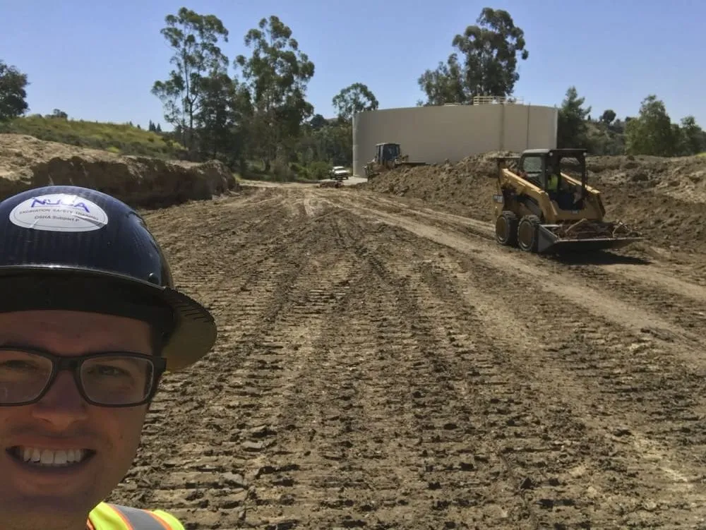
Define the Turnover
Rough grading vs. finish grading
The contract should state who establishes the elevations, what field condition is included and who tests or accepts it. Each city sets its own grading permit rules: very small cuts and fills can be exempt, but building pads usually need a permit, a grading plan and a soils report. Disturbing an acre or more also needs coverage under the state’s construction stormwater permit, with a SWPPP, and SCAQMD Rule 403 requires dust to stay on site.
Rough grading
Major excavation, fills, slopes, pads, access and subgrade shaping performed from issued plans and control.
Finish grading
More precise surface preparation for paving, flatwork, landscaping or other following work when expressly included.
Civil and drainage design
Elevations, drainage intent, calculations and design acceptance remain with the responsible licensed professional.
Survey and geotechnical records
Control, grade checks, soil recommendations, observation, tests and certifications come from assigned qualified parties.
Information Before Earth Moves
Turning a grading plan into yards of dirt
Soil swells when it is dug: a cubic yard in the ground takes about 1.25 cubic yards in the truck, and clay and rock swell more. It shrinks again when it is compacted, so a site that balances on paper can still need import or export.
It does not establish legal boundaries, certify elevations, characterize soil, locate every utility, approve drainage or determine compaction acceptance.
- Current civil, demolition and utility plans.
- Existing and proposed surfaces with issued survey control.
- Earthwork takeoff, stripping and removal assumptions.
- Geotechnical recommendations and testing assignments.
- Known soil, fill, groundwater and environmental information.
- Utility notification, locating, potholing and protection plan.
- Import source and export destination criteria.
- Access, haul, work-hour, dust and track-out constraints.
- Drainage, erosion, stormwater and weather requirements.
- Written grading tolerance, next-trade and acceptance criteria.
Material Balance
Will the site balance? Cut, fill, import and export
A balanced-looking plan may not be balanced after stripping, removals, shrink or swell, unsuitable material and compaction requirements are applied.
- 01
Cut
Excavate to issued limits while tracking material type, utilities, stability and haul path.
- 02
Fill
Place accepted material in the required locations, lifts and moisture condition under assigned testing.
- 03
Import
Confirm source, specification, availability, delivery, contamination controls and acceptance before placement.
- 04
Export
Confirm characterization, destination, truck cycle, disposal terms and required records before hauling.
Keep quantities qualified: until survey and field records establish the basis, unknown earthwork belongs in allowances, unit prices or explicit assumptions.
Source-Derived Work Packages
What grading sets up for the next trade
01
Site Clearing & Stripping
Defined vegetation, surface material, pavement and unsuitable layer removal before earthwork.
02
Cut & Fill
Excavation and placement tied to issued surfaces, material criteria and documented quantities.
03
Pad & Subgrade Support
Field preparation for foundations, paving and improvements under written tolerance and testing assignments.
04
Utility & Trench Access
Excavation and corridor preparation after notification, locating, release and specialty-trade planning.
05
Aggregate Base & Access
Material placement and shaping for temporary or permanent access when specifications and acceptance are defined.
06
Drainage & Erosion Interfaces
Contracted shaping and controls executed from issued design and project-specific environmental requirements.
From Existing Surface to Accepted Scope
How a grading job runs, step by step
The responsible professionals provide design and acceptance; the contractor maintains the field record and performs the released work.
- 01
Define
Limits, surfaces, quantities and tolerance.
- 02
Investigate
Survey, soil, utilities, materials and access.
- 03
Assign
Design, testing, owner and contractor roles.
- 04
Release
Permits, marks, environmental and work gates.
- 05
Strip
Remove designated surface and unsuitable material.
- 06
Move
Cut, fill, condition, import or export.
- 07
Verify
Arrange grade checks, observation and tests.
- 08
Turn Over
Record condition, results, open items and acceptance.
Field Acceptance
Compaction tests and the pad certification
Fill goes in thin lifts at the right moisture, and most Southern California soils reports call for at least 90 percent relative compaction by ASTM D1557, often 95 percent under paving. The testing lab’s results and the soils engineer’s report are what the building inspector relies on to sign off the pad.
Measure
Surface and quantity basis
Use issued survey control and current and proposed surfaces to define stripping, cut, fill and tolerances. Track quantity assumptions separately from field-measured changes.
Qualify
Material and destination basis
Reconcile geotechnical recommendations, suitability, moisture, shrink or swell, import source, export destination and environmental restrictions before changing the truck plan.
Accept
Testing and handoff record
Arrange grade checks, observation and compaction testing with assigned professionals; then record tickets, changed conditions, open items and the written acceptance point.
Read the comparison with the project record. The comparison below documents a visible site change; it does not establish boundaries, design grade, soil suitability or compaction acceptance.
Interactive Field Comparison
Before and after: a graded site
Drag the divider or use the arrow keys to compare the two retained field views.
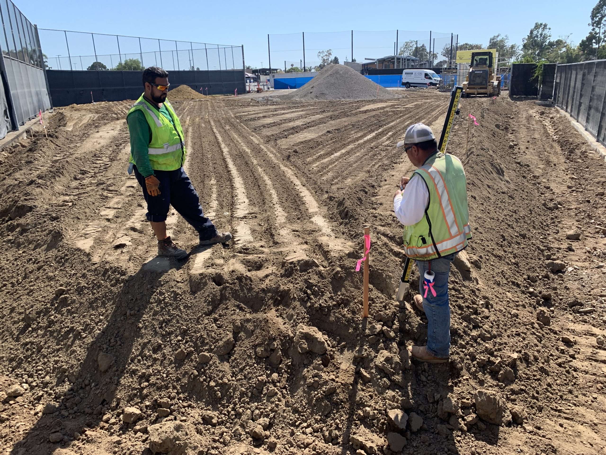
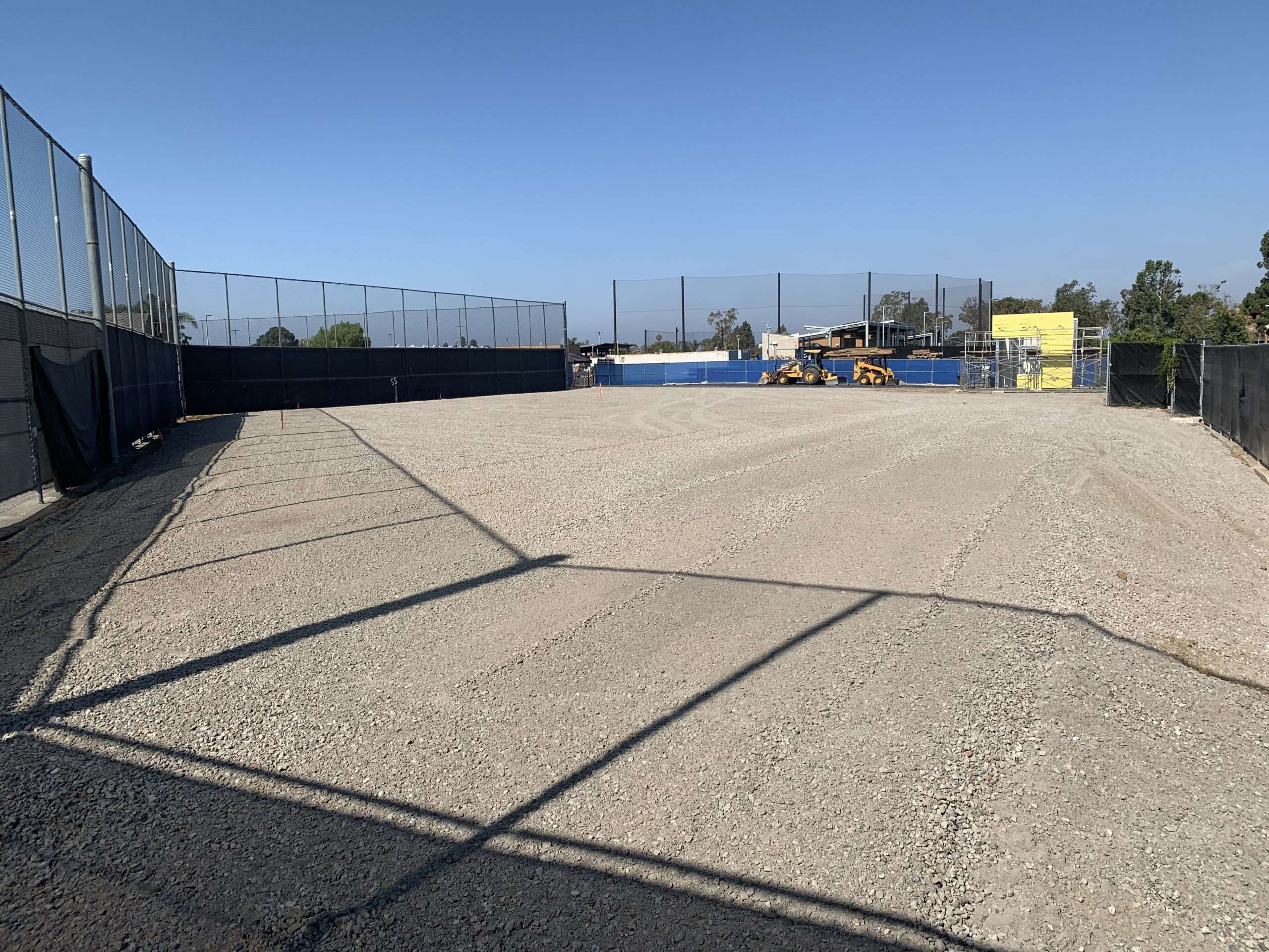
Read the image with the project record: a finished-looking surface is not evidence of property boundaries, soil suitability, compaction certification, design compliance or readiness for every following trade.
Five-Party Responsibility Map
Who stakes, tests and signs off
Owner / Agency
Provides site authority, intended use, known records, schedule, destinations and acceptance contact.
Civil / Survey Professionals
Provide assigned design, boundaries, control, elevations, staking, checks and certifications.
Geotechnical / Testing
Provide soil recommendations, observation, tests, results and acceptance within their assignment.
SoCal Removal
Performs the contracted excavation, placement, conditioning, grading support and field documentation.
Utilities / Environmental Parties
Provide assigned responses, locating, releases, evaluation, monitoring and changed-condition decisions.
Project Questions
Grading and excavation questions
What grading work can SoCal Removal perform?
A contracted scope may include excavation, cut-and-fill handling, rough shaping, subgrade preparation, trench or utility access support, aggregate-base placement support, temporary access and import or export planning. The proposal defines limits, elevations, quantities, materials, testing, tolerances and work by others.
What is the difference between rough grading and finish grading?
Rough grading establishes major cuts, fills, slopes, pads and access based on issued criteria. Finish grading brings surfaces closer to the tighter elevations and tolerances required for paving, landscaping or other finishes. Which condition is included must be written; neither term by itself establishes design or acceptance.
Does SoCal Removal design drainage or certify final grades?
No. Civil design, drainage calculations, legal boundaries, survey control, grade certification and professional opinions remain with appropriately licensed professionals. SoCal Removal can perform contracted field work from issued information and report conflicts or changed conditions.
Who determines whether soil is suitable or compacted?
The assigned geotechnical professional and testing agency provide project-specific soil recommendations, observation, testing and acceptance records. SoCal Removal performs the contracted excavation, conditioning, placement and compaction effort required by the documents, but does not issue geotechnical certification.
How are cut, fill, import and export quantities handled?
Quantities should be based on current surfaces, design grades, shrink or swell assumptions, stripping, removals, unsuitable material, utility work and the planned compaction condition. Unknown balance should remain an allowance or unit-price basis until survey and field records support a firmer quantity.
What happens if buried debris, utilities or suspect soil is encountered?
The affected work is stopped and stabilized as needed, the condition is photographed and located, and the owner and assigned utility, design, environmental or testing parties evaluate it. Scope, schedule, notification, handling, destination and change authorization are resolved before affected work resumes.
What affects grading cost and schedule?
Major drivers include quantity and haul distance, soil type and moisture, import or disposal charges, access, equipment productivity, utility exposure, environmental conditions, work hours, weather, dust and track-out controls, survey and testing response, lift requirements and the specified final tolerance.
What information should be submitted for a grading estimate?
Send current civil and demolition plans, existing and proposed surfaces, issued survey control, earthwork quantities, geotechnical reports, utility information, environmental reports, material specifications, import or export criteria, access and haul restrictions, testing assignments, schedule and written turnover requirements.
Start With the Surface and Quantity Basis
Send the grading plan and soils report for a price
We will organize the contractor scope, identify missing releases and keep unresolved quantity or acceptance risk visible.