Contractor Support—Not Professional Land Surveying
Site Verification & Utilities Before Disturbance
SoCal Removal organizes the records, field access, issued control, utility responses and selected verification steps needed to plan its contracted demolition, excavation and grading work. Property lines, legal descriptions, topographic or boundary surveys, design, grade certification and other professional land-surveying services remain with an appropriately licensed land surveyor or other authorized professional.
Who Establishes the Line—and Who Builds to It?
Who marks what: surveyors, utility locators and the contractor
Good planning preserves that separation while making sure the issued information reaches the people disturbing the site.
Establishes professional survey information
Performs assigned boundary, monument, topographic, control, construction-staking, elevation, legal-description and as-built services.
Defines purpose and issued criteria
Selects the professional scope, provides plans and resolves design, property, tolerance and acceptance decisions.
Provide system-specific responses
Facility owners, qualified locators and specialty providers perform assigned notification, marking, scanning or locating work.
Uses issued information for contracted work
Arranges access, protects identified references when included, performs released field work and reports visible conflicts or changed conditions.
Information Before Disturbance
What to gather before anyone digs
California law requires a DigAlert ticket at least two working days, and no more than 14 calendar days, before digging, and the ticket stays good for 28 days. The utilities mark only their own lines, usually up to the meter, so private lines on the property, such as site lighting, irrigation and sewer laterals, need records or a private locator. The required package depends on what will be demolished, cut, excavated, graded, retained and built next.
Plans, marks, scans and selected exposure do not prove every concealed condition, replace professional services or guarantee that the field matches historical records.
- Boundary, topographic, control and staking records from the responsible surveyor.
- Current civil, demolition, structural and utility plans.
- Record drawings, easements and owner utility information.
- DigAlert ticket and positive-response status.
- Private utility, abandoned-system and facility records.
- Environmental, geotechnical and material reports.
- Marked disturbance, protection and retained limits.
- Required potholes, test pits, openings or scan areas.
- Access, occupancy, work-hour and public-interface constraints.
- Named authority for conflicts, revisions and release.
Ways to Reduce Uncertainty
Records, locating, scanning or potholing: which one you need
Tools answer different questions and have different limitations. No single method proves a site is free of unknown conditions.
- 01
Records & Issued Survey
Establish the documented basis, date, source, control and expected facilities or features.
- 02
Notification & Locating
Obtain utility-owner responses and assign qualified private locating for applicable site systems.
- 03
Scanning
Use GPR, electromagnetic methods, concrete scanning or radiography where selected by qualified providers.
- 04
Direct Exposure
Pothole, hand expose, vacuum excavate, test pit or open selected areas under the applicable controls.
Information Families
Six kinds of site information, and where each comes from
01
Property & Boundary
Legal, monument, line, easement and access information from the responsible professional and owner.
02
Topography & Grade Control
Existing surfaces, datum, points, stakes and design elevations needed for the defined field task.
03
Utilities & Subsurface Features
Owner records, facility responses, private locating and selected exposure for expected systems.
04
Existing Structures
Location, dimensions, structural information, concealed assemblies and retained-condition interfaces.
05
Materials & Environment
Surveys, sampling and laboratory information from assigned qualified parties before disturbance.
06
Soil & Geotechnical
Recommendations, test locations, groundwater and acceptance criteria from the responsible professionals.
Planning Sequence
From the first records to the day work starts
The sequence protects each party's scope and creates a clear changed-condition path.
- 01
Define Work
Identify disturbance, retained items and acceptance.
- 02
Assign Roles
Name owner, survey, design, utility and testing parties.
- 03
Receive Records
Confirm current documents, dates, basis and limitations.
- 04
Mark & Locate
Complete required notifications and selected field work.
- 05
Expose
Directly verify selected conditions when required.
- 06
Release
Resolve conflicts and authorize the affected task.
- 07
Protect
Maintain designated stakes, points and known facilities.
- 08
Report
Document changed conditions and request restaking or revision.
Field Information in Use
What a paint mark can and can’t tell you
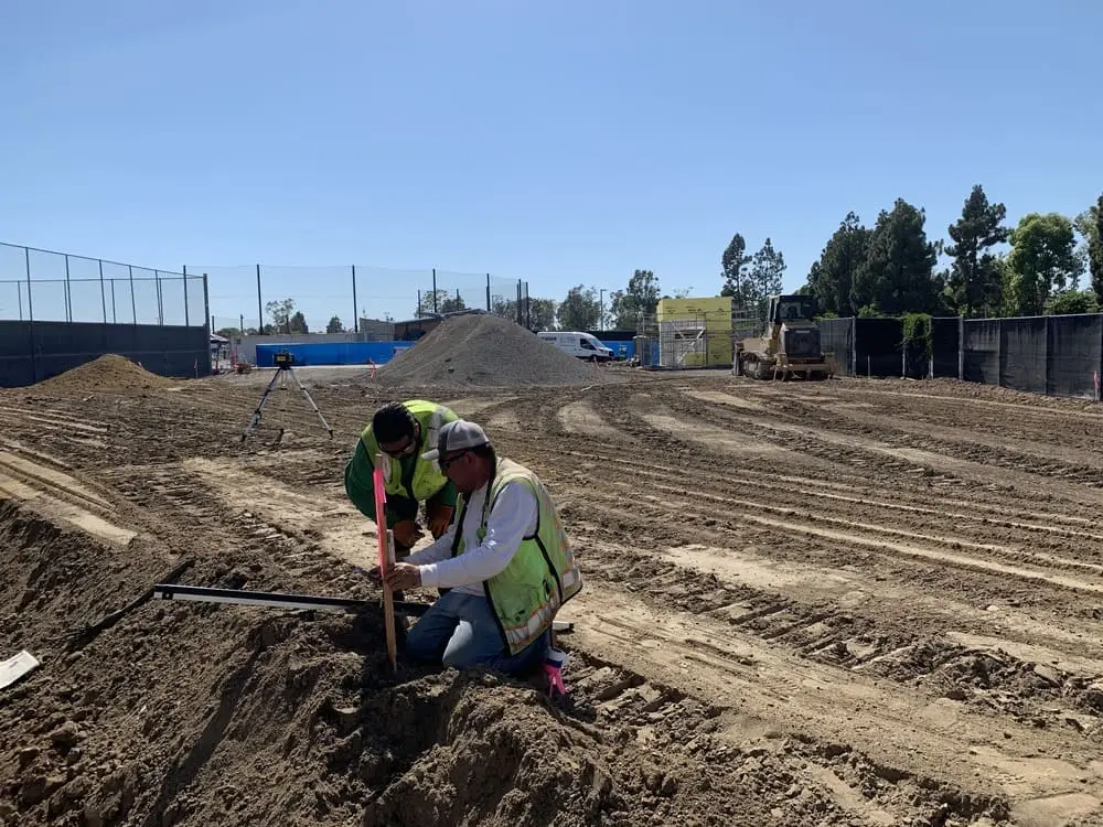
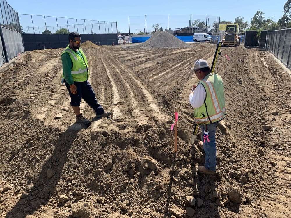
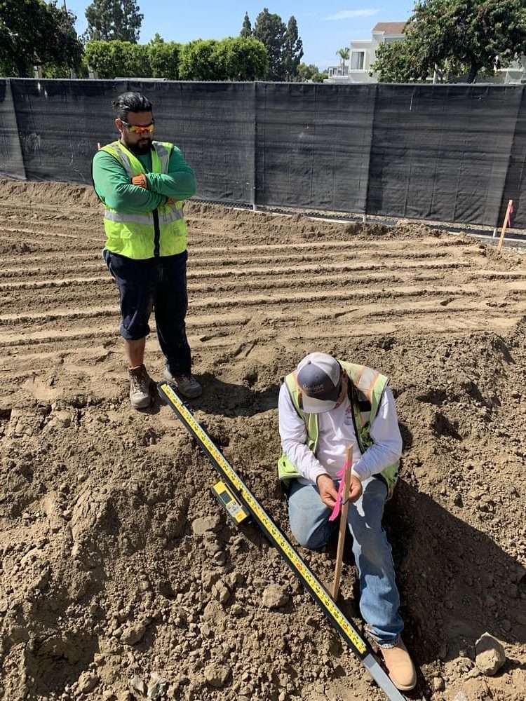
These retained photographs from the legacy Site Verification page document contractor use of field information. Locating, scanning and selected exposure can reduce uncertainty, but they do not establish property lines, certify design or engineering conclusions, or identify every concealed service.
Traceable Field Information
Reading the colors and marks on a job site
Marks follow a standard color code: red for electric, yellow for gas and oil, orange for communications, blue for drinking water, green for sewer and storm drain, purple for reclaimed water, pink for survey marks and white for the planned dig area. Within 24 inches of a marked line, digging is done by hand or vacuum until the line is exposed.
Source
Who established it, and for what?
Record the responsible surveyor, utility owner or locator; the date, datum or reference, ticket or drawing; and whether the mark represents a property line, grade, utility or construction control.
Reconcile
Compare records, marks and selected exposure
Resolve stale or inconsistent information through the responsible parties. Qualified locating, scanning, potholing or test openings may answer selected questions but cannot prove the absence of unknown conditions.
Protect
Use, preserve and report
SoCal Removal works from issued information within its contracted scope, protects designated control, documents visible conflicts and requests restaking, revision or release before affected work continues.
Contractor support—not professional land surveying. SoCal Removal uses issued field information for contracted work; it does not establish property lines, certify survey control or replace the responsible professional.
Role Boundary
Who is responsible for what
Owner / Agency
Retains required professionals, provides records and resolves property, purpose and acceptance decisions.
Licensed Surveyor / Designer
Provides the professional survey, control, design, staking, certification or as-built services assigned.
Utilities / Locators / Consultants
Provide their assigned responses, locating, scans, tests, interpretations and release information.
SoCal Removal
Gathers the inputs and performs only its released demolition, excavation or grading contract scope.
Project Questions
Site verification and DigAlert questions
Does SoCal Removal provide professional land surveying?
No. SoCal Removal does not establish legal boundaries, prepare legal descriptions, set monuments, certify elevations or provide professional land-surveying services. Those services must be performed by an appropriately licensed land surveyor or other professional authorized for the assignment.
What does site verification mean on this page?
It means organizing existing records, owner-provided surveys, issued control, utility responses, environmental information, field observations and selected locating or exposure tasks so the contracted demolition, excavation or grading scope has a clearer starting basis. It does not mean every condition has been found or professionally certified.
Who establishes property lines and construction control?
The owner retains the appropriately licensed surveyor or responsible design professional to establish the required boundary, monument, control, staking, elevation or as-built information. SoCal Removal uses issued information for its contracted work, protects designated references when included and reports visible conflicts.
What is the difference between DigAlert and private utility locating?
DigAlert starts the statutory notification process for participating facility owners. Private systems, laterals, abandoned lines and site-owned facilities may require separate records and qualified locating. Project-specific excavation planning can also require potholing or careful exposure near expected facilities.
Can GPR or concrete scanning find every buried or embedded item?
No. Ground-penetrating radar, electromagnetic locating, concrete scanning and radiography use different principles and have different limitations. Selection and interpretation belong to qualified providers. Results reduce uncertainty at selected locations but do not replace survey, utility-owner responses, design review or direct verification.
When is potholing or controlled exposure useful?
It may directly verify the location, depth or condition of a selected expected feature after notification, access, excavation, material and safety requirements are established. It does not prove that every facility or obstruction has been found.
How are suspected hazardous materials or contaminated soil addressed?
Independent qualified parties perform assigned surveys, sampling, laboratory analysis and environmental decisions. SoCal Removal arranges its contracted field work around the issued results, regulated-work assignments and changed-condition procedure.
What should be submitted for a site-information review?
Provide current surveys, civil and utility plans, record drawings, geotechnical and environmental reports, DigAlert or utility responses, private-locate records, photographs, marked work limits, access conditions, desired schedule and the identity of the responsible survey, design, utility and testing parties.
Begin With the Records You Have
Send what you have, even if the records don’t agree
Professional surveying, engineering, testing and utility decisions remain with their responsible parties; our review connects those inputs to the planned field scope.